
1.05Initial Release
1.06Improved GPS reading to cope with (hopefully) all systems. Can now use several types of NMEA sentence.
1.07Fixed bug that prevented RealMaps from being able to use maps stored on drive D:
Fixed bug that prevented RealMaps from being shut down by the system screen.
1.08 (This version onwards can use the same INI file)Revamped the handling of flash disks (again) - although this did work, too many users were still having problems. I have therefore removed the restriction that prevents RealMaps from being installed solely on drive D: and improved the startup dialog that allows the user to specify where the maps are located.
1.09Fixed the Helpfile handling routines so that you can use the 'Go Back' button instead of having to close the help each time it is used.
Added the ability to drag maps around with the pen.
Improved handling of smaller-than-screen images.
Added option to use 16-colour screen (16 colour MBMs scroll much faster and look better with this option switched on but it slows down 4 colour images)
1.10Modified the 'About' dialog to show that the software is registered.
Added the facility to create 'Hot Zones'. These are datafiles that are created from within RealMaps and are specific to each map image. A trivial use of these hot zones is to create additional names that are local to the particular map, although generally it is far better to just to add these permanently to the image. The more useful application of these Hot Zones is to store additional data about particular regions in one of the following formats :-
- Up to 255 characters of text (always available in addition to one of the attachment file types below)
- Word
- Data
- Sheet
- Sketch
- Record

This extends the capability of RealMaps so that it can be used as a Geographically-Arranged DataBase, applications include surveying, local tourist information, census information, data-capture, materials-handling/storekeeping, sales contacts, plant-maintenance (I could go on forever here)... anything that involves storing data by it's location.
The attachment files also reside in the users ...\MapInfo directory.
Additional GPS information is now available using $GPRMC or $GPGGA sentences :-
v1.11Fixed a minor problem displaying maps with one (but not two) dimensions smaller than the screen. Also enabled dragging of such images using the pen like the large maps but in one direction only.
v1.12Added additional keyboard shortcuts (shift-P for 'Find Place' and Z to enable HotZones)
Added registered user name to title screen and shareware reminders on loading and exiting the program - thus making latest version available for download to all.
v1.13Added the ability to register within the program.
v1.14Added option to trace GPS movement onto the underlining map. This gives RealMaps the ability to create maps automatically by driving around with a GPS running.
Added ability to annotate maps with additional text that can be permanently saved if desired.
Added facility to save annotated/traced maps.
v1.15Extracted all the menu, dialog, and message strings to a separate file RM-RSC; this is directly editable with the Psion's Data application. This resource can be translated to allow international support. I already have someone working on a Swedish version. Anyone wishing to help me create other international versions of RealMaps please email me for more details. Assistance will be rewarded with a free registration and an acknowledgement on my web pages when the new version is posted.
The last string used in a 'Find Place' is now entered as the default annotation making it easier to add placenames permanently to a map.
The speed units shown by the GPS 'Extra Info' may be displayed in mph or km/hr.
An option to display the current map status has been added. A fix routine has been added to this; in the event that reference points are defined the wrong way round, RealMaps can (usually) fix the problems so that maps zoom correctly.
Open, Zoom In, Zoom Out, Last Waypoint, Next Waypoint have been added to the keypress options in GPS mode.
Changes have been made to the GPS routines to avoid unhelpful error messages with some GPS systems. The function of the 'Ignore Errors' option has been changed to take account of this.
The reading of the ??GLL NMEA sentence has been fixed so that it works correctly in western longitudes.
v1.16Supports more than one language resource file selectable from the menu. Spanish, French, Swedish, & US English are also included in this release.
Further speed improvements to GPS read routines particularly with regard to handling errors in the incoming data stream. This is a major overhaul, hence the decision to leave v1.15 available above.
Fixed bug that prevented min/max map extents being set correctly on first definition.
Added an additional feature to the 'Add' menu - Country/Capital/Cities may now be semi-permanently overlaid on maps.
Added check and auto-fix for WorldCities.S5 in case handling it on other machines converts it to DOS 8.3 file format.
v1.17Significant improvements to the GPS routine - will now exit cleanly even if the serial port is disconnected. This version is an intermediate and won't actually be released.
v1.18Added logging and playback of GPS data.
Added vector overlay feature.
Added Printing of maps and screens.
Modified helpfile to include revision date for each field (helpful for translators)
Support for 2 colour images
Auto-selection of colour mode.
v1.19 - Version Number Skipped to Save Intermediate
v1.20Added patch routine so that saved bitmap images are directly usable with BMCONV
Modified bitmap save routine so that it checks for success before deleting old version.
Improved SW / NW point referencing and added facility to jump to the current map extremities.
Added routine to quickly save current cursor co-ordinates to a text file with an optional text string (useful for making overlays)
N,S,E,W now in resource file so that they can be changed to country-specific strings (eg. N,S,E,O for France)
Added facility to calculate distance to the current marked point (also moved gps speed units to more general 'Distance Units' setting in the cursor step dialog box)
Made the 'persistent' co-ordinates larger in response to a user request.
User preferences (eg GPS settings, persistent co-ordinates, distance units etc.) are now retained.
More than one help file can be used - country-specific help files should now be renamed, eg. RealMaps-F.HLP for France, RealMaps-D.HLP for Germany etc. Switching the current language resource will switch to the appropriate country-specific help file if one exists or default to RealMaps.HLP
Added the facility to set the display format for lat/long degrees to 0°00.00', 0°00.000', or 0.00000° and it now affects all position and status displays. The setting is also saved as a preference.
Added a patch routine to the 'Save Map' feature which stores the reference information at the end of the map data. This removes the need to use '*.RMi' info files when distributing maps. The loading and saving of 'Info' files will be removed from later revisions but they are retained for now.
v1.21Fixed bug that prevents GPS from working correctly if a comma is used for the decimal divider instead of a point (see international settings in the Control Panel).
Added variable delay time to GPS log.
Series 3a/3c/3mx Version 3.01b made available includes the following features :-New plain text overlay files make it easier to transfer information and use GIS information downloaded directly from the web. This is a very versatile format handling the following types :-
Once the user has selected Lat-Long or Long-Lat format, both point and vector data, with or without detail data, can be handled in the same plain text file.
Track.txt (ie. the file created by the Q and W keys) data layout is now consistent with new text-based overlays allowing the track file to be used as an overlay
3.02 Full Release Will Include :-
Bug fixes from 3.01beta - Save Modifications Overwrite fixed.
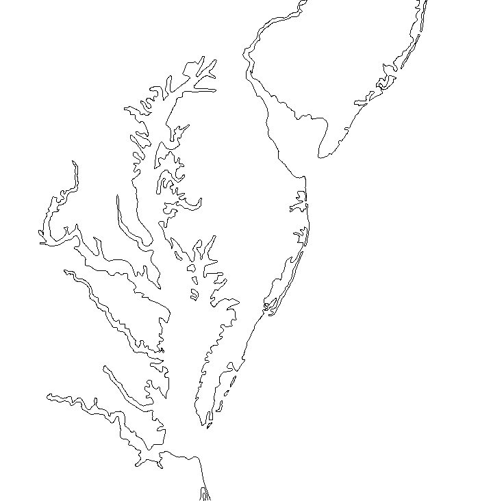
Create Blank Map Image - semi-automated process that allows user to create a correctly-scaled blank image in order to make a new map based on overlays or GPS data. Here is an example of an image created solely on a 3c using this new feature and MapGen data downloaded from the internet :- USA-NW1.gif
5.02
Improved, higher-visibility moving-map GPS cursors.
RMi 'info' files dropped in favour of the simpler patch system introduced in v1.20.
New plain text overlay files make it easier to transfer information and use GIS information downloaded directly from the web. This is a very versatile format handling the following types :-
Once the user has selected Lat-Long or Long-Lat format, both point and vector data, with or without level data, can be handled in the same plain text file. Text-based overlays are interchangeable between series 3 and series 5 versions.
Track.txt (ie. the file created by the Q and W keys) data layout is now consistent with new text-based overlays allowing the track file to be used as an overlay.
Create Blank Map Image - semi-automated process that allows the user to create a correctly-scaled blank image in order to make a new map based on overlays or GPS data.
A 250KB optional special overlay is available. This is a compressed 1.3MB vector file of the world coastlines. By creating a blank map image and using the new 'Draw Coast' option, a rough coastline can be generated for any region of the world.
Series
3a/3c/3mx Version Released at v3.02
In moving map mode
the cursor keys can be used to shift the current position by a constant
amount in the X and Y directions.
A new GPS sentence mode has been added ('*') - this assumes that the current NMEA output supplies the RMC, GGA, and RMB sentences and displays Course over Ground (COG), Heading, Altitude, GPS Waypoint Name, GPS Waypoint Distance, Latitude, Longitude, GPS signal type, & number of satellites. Validity is indicated by the text changing to grey when invalid RMC sentence data is received.
Here's a screenshot :-

This works well on my Garmin GPS12 and should operate with any system that can output RMC, GGA, RMB plus 'some-other-sentence-apart-from-these-three'. Why's that necessary ? - well to update the screen, perform all the calcs, and process all these NMEA sentences in OPL is a fair task for the Series 5 classic. The loop looks for each of these strings and grabs the information in turn, but updating the screen occurs in the 'junk' bit after that. This maximises the speed and enables it to avoid dropping any serial frames even when saving a log and reading data at up to 19200 baud.
Added facility to generate 'Great Circle' route tracks. These plot the shortest route between two points anywhere on the globe. Also added an initial course heading to the cursor when the 'Show Distances' option is selected and you are some distance away from the marked point. At closer distances it is better to follow the rubber band that now joins the current position to the selected point.
Improved the use of alternative language resource files. You can now use old versions directly because any missing entries are taken from the UK English version (RM-RSC.GB). Also added a tickbox to the language-selection dialog. When this is ticked all resource items are prefixed with their number (so that their context can be easily identified) and two additional options become available:-
Added facility to alter the size of the directional GPS cursor.
Fixed bug in knots speed display on new GPS mode.
Adding support for external programs. This is in the form of a database file containing the current GPS information. External programs can read this database using the supplied routines and perform asynchronous tasks based on its contents. An example program in parallel development uses a series of sound files to announce GPS events, eg. "New Waypoint", countdown to waypoint and speed warnings. This should also allow easy interfacing with waypoint upload programs because I've added an event when the <Enter> key is pressed in normal mode.
Added support for Degrees, Minutes, Seconds format and improved multi-format Lat/Long input box.
Modified the GPS and playback routines so that they 'tickle' the auto-switch-off timer countdown - preventing the Series 5 from switching off while in these routines.
Added a new 'Units' dialog box. Speed, Altitude, & Distance can now all have different units if desired.
v5.05
Fixed the V key function for Series 7 and Revo
Fixed the vertical GPS extra info window for the Series 7
Link is now automatically disabled during GPS moving map unless actually in use (no need to remember to switch it off in the system screen before executing GPS moving map mode).
Fixed the GPS info windows so that they autodetect the Revo and adjust accordingly - also created a bit more room by using full screen width for horizontal versions.
Now Revo Compatible
v5.06 - Skipped to 5.07
Decided that autorecognition of GPSS (*.DES) and UI-View (*.INF) map reference files would be shelved for now but a utility program to batch process these types of maps would be produced instead.
Fixed problem with the display font size of non-capital cities on the Revo.
Improved the '*' GPS mode so that it can use the $GPVTG sentence when the $GPRMC sentence is missing. This allows the moving map feature to work correctly with the Palmtop GPS which outputs an unusual NMEA collection.
Improved the error handling on the GPS moving map mode so that it doesn't resort to closing and reopening the port nearly as often when invalid data is received. Whilst this wasn't technically a bug, and didn't cause problems on the Series 5, it could hog memory and slow down the machine on the 5mx/Revo (in extreme circumstances it was even reported that the machine could hang - although I was never able to repeat this).
v5.07
Fixes as per v5.06
RealMaps now co-operates with the latest version of PsiGar5 so that waypoints can be easily defined using RealMaps and recorded/uploaded by PsiGar5 to a Garmin GPS.
Europe.MBM and World2.MBM maps modified (old West-/East-German border removed)
v5.08 Support for non-cylindrical projections - can
now handle national grid maps
Enhanced coordinate entry system with support for user-defined grid reference conversion modules. (example OS GB grid module included)
Improved map referencing system avoids most user errors
Ctrl-Arrow keys jumps half a screen at a time.
v5.09
Shift-K Shortcut to switch to PsiDat if running.
New 'Draw Grid' overlay option
Minor internal changes
v5.10
Modified the routine used to embed/read the map reference data within an MBM file so that maps can be interchanged between a real EPOC device and the emulator.
Added extra precision options to the coordinate display units.
Added automatic patching of the MapList file with the PsiDat UIDs so that it can be easily edited by tapping it from the system screen when PsiDat is installed.
Added support for PsiGar5-exported text overlay files so that waypoint icons can be overlaid in two sizes (NB: this feature is enabled for registered users only).
Made the 'About|RealMaps 'dialog
report
the user's key as well as their name.
v5.11
Removed the (pointless) colour-mode switching on Series 7 and netBook
Added support for GaRoute
v5.12
v5.13
Series 3 Download and Info Page
Last updated 13th September 2003
[ Home ]